Projects

Our Projects

Flagship projects for strategic clients in transport, housing and infrastructure — and examples of airborne and marine LiDAR scans.

Project card — Netivei Israel
Transport infrastructure

Netivei Israel — hundreds of kilometres of national roads

Surveying, registration plans and expropriations along hundreds of kilometres of roads — from Route 2 to Route 443 — plus orthophoto for the Eilat railway project.


Surveying · Expropriations · Orthophoto · Registration plans

Project card — Israel Railways
Transport infrastructure

Israel Railways — planning, expropriation & registration support

Planning support for dozens of rail projects: electrification of 450 km of track, the Valley Railway, the Eastern Railway, the Akko–Karmiel line, the Eilat line and the coastal quadrupling.

Surveying · Expropriations · Laser scanning · Registration plans

Project card — NTA
Transport infrastructure

NTA — the Metro and the Green, Brown and Purple lines

Surveys for detailed and town-plan design, boundary documentation and expropriation support for NTA — the M1S Metro section and the Green, Brown and Purple lines.

Surveying · Expropriations · Mass transit

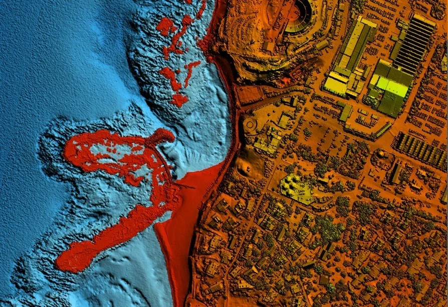
Colour-coded elevation model from a LiDAR scan at Sdot Yam
LiDAR & marine mapping

LiDAR scan at Sdot Yam

A continuous airborne LiDAR scan of the shore, seabed and land — a single 3D model joining topography and bathymetry.

Airborne LiDAR · Bathymetry · Coastline

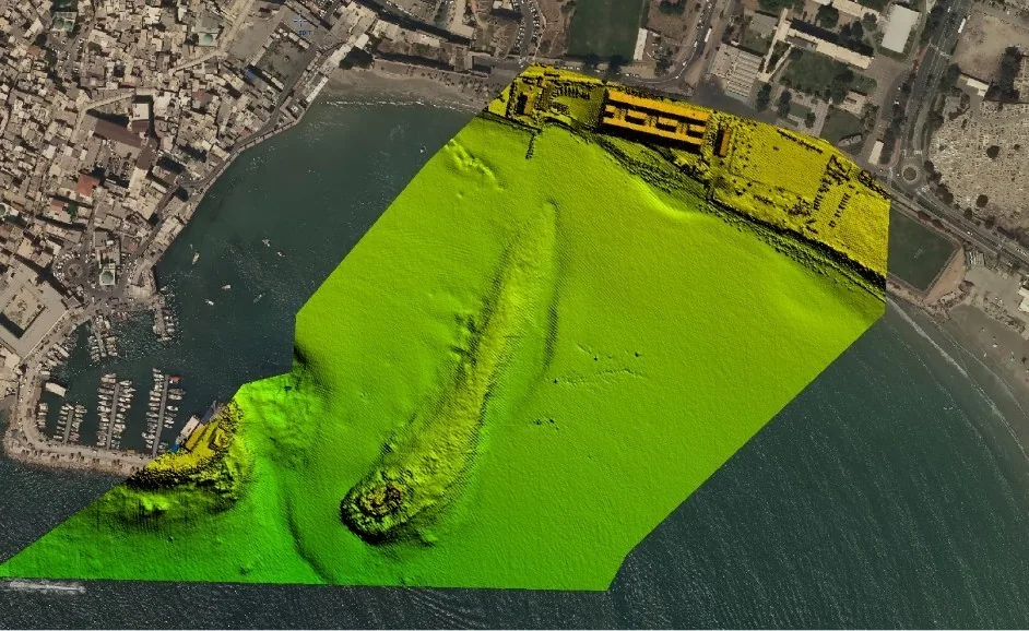
Elevation model of Akko harbour from a LiDAR scan
LiDAR & marine mapping

LiDAR scan at Akko

A LiDAR scan of Akko’s harbour and old city — a continuous elevation model of the port, breakwater and adjacent seabed.

Airborne LiDAR · Harbour · Bathymetry

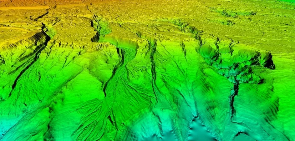
Elevation model of a canyon from a LiDAR scan
LiDAR & marine mapping

LiDAR scan of a canyon

An airborne LiDAR scan of complex terrain — a detailed elevation model of stream channels, slopes and escarpments.

Airborne LiDAR · Topography · Streams

Project Map

Selected projects nationwide — click a marker for details.

Loading map…

Map © OpenStreetMap contributors

Have a similar project?

We'd love to hear about your challenge and offer a precise solution.

Contact Us