
Marine Surveying
Bathymetric surveys in lakes and along the coast, carried out with a certified marine surveyor and combined with airborne LiDAR scans — for complete seabed mapping for planning, management and safety.
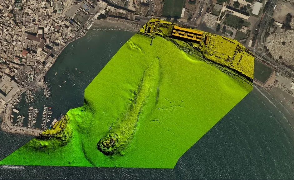
Marine surveying and bathymetry
Bathymetric surveys in lakes and along the coast are carried out with a certified marine surveyor and combined with airborne LiDAR scans for complete seabed mapping for planning, management and safety.
Marine surveys complement the company’s land surveys and airborne LiDAR scanning, producing one continuous model of the shore, lake or sea — from dry land down to the seabed.
Frequently asked questions
Who performs the marine surveys?
Marine surveys are carried out with a certified marine surveyor, combined with airborne LiDAR scans.
More services
Aerial Mapping & Photogrammetry
Photogrammetric mapping, vertical and oblique aerial photography, colour and multispectral orthophoto and GIS — with the Leica DMC250, one of the world’s best systems, approved by the Survey of Israel.
LiDAR Scanning
Airborne, ground and marine laser scanning with world-leading technology — the Leica Chiroptera 4x scans topography and bathymetry simultaneously, down to a seabed 25 metres deep.
Land Surveying
A leading land-surveying company committed to high-quality work — with 6 full land-survey crews operating in the field on an ongoing basis, using advanced laser and GPS‑RTK equipment.
Appraisal, Cadastre & Land Registration
Boundary reconstruction, registration plans, town-plan compilation, area calculations for balancing tables, appraiser support and expropriations — with over 400 registration plans approved a year with the Survey of Israel.
Interested in this service?
We'll accompany you from planning to final deliverables.