
LiDAR Scanning
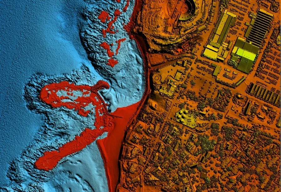
Airborne, ground and marine laser scanning with world-leading technology — the Leica Chiroptera 4x scans topography and bathymetry simultaneously, down to a seabed 25 metres deep.
What is LiDAR?
LiDAR (Light Detection and Ranging) measures distance using laser pulses. Timing the return of each pulse gives a range, and millions of measurements per second build a 3D “point cloud” of the surface and the objects on it.
Chiroptera 4x — unique worldwide
An airborne bathymetric and topographic laser-LiDAR system by Leica. It is a unique, expensive system, among the few in the world equipped with a precise IMU, that scans topography and bathymetry simultaneously, down to a seabed 25 metres deep, at high accuracy.
Scanning is continuous, as a single unit and at high point density, combined with colour RGB and NIR digital aerial imagery from a precise mapping camera.
What do we actually map?
- Depth mapping in the Sea of Galilee, Lake Hula, the Dead Sea, the Mediterranean, water reservoirs and streams.
- Mapping areas and depths in the Dead Sea for documentation and quantity monitoring — a unique job performed by the company.
- Precise airborne and ground scans for infrastructure, such as rail projects.
- Topographic mapping of complex terrain — canyons, streams and slopes.
Examples from the field
The company has published example scans at Sdot Yam, Akko and a canyon — see the projects page. The LiDAR system scans many types of terrain at different sizes, at engineering accuracy and in short timeframes.
Scan types
- Airborne: large areas, infrastructure and long corridors.
- Ground: detailed scans of structures, sites and infrastructure sections.
- Marine: seabed and coastal strip mapping for planning, management and safety.
Frequently asked questions
What is the difference between topographic and bathymetric LiDAR?
How deep can it map?
Which water bodies has the company mapped?
Does LiDAR replace traditional marine surveying?
What does a LiDAR deliverable look like?
More services
Interested in this service?
We'll accompany you from planning to final deliverables.