Netivei Israel — hundreds of kilometres of national roads
Surveying, registration plans and expropriations along hundreds of kilometres of roads — from Route 2 to Route 443 — plus orthophoto for the Eilat railway project.
Our services
Guides & articles
LiDAR & marine mapping
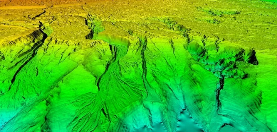
An airborne LiDAR scan of complex terrain — a detailed elevation model of stream channels, slopes and escarpments.
An example of a land LiDAR scan: a steep, dissected landscape scanned at high point density. The result exposes the drainage pattern, escarpment lines and slopes in a level of detail that is hard to achieve by ground methods.
The company’s LiDAR system scans many types of terrain at different sizes, at engineering accuracy and in short timeframes.