Netivei Israel — hundreds of kilometres of national roads
Surveying, registration plans and expropriations along hundreds of kilometres of roads — from Route 2 to Route 443 — plus orthophoto for the Eilat railway project.
Our services
Guides & articles
LiDAR & marine mapping
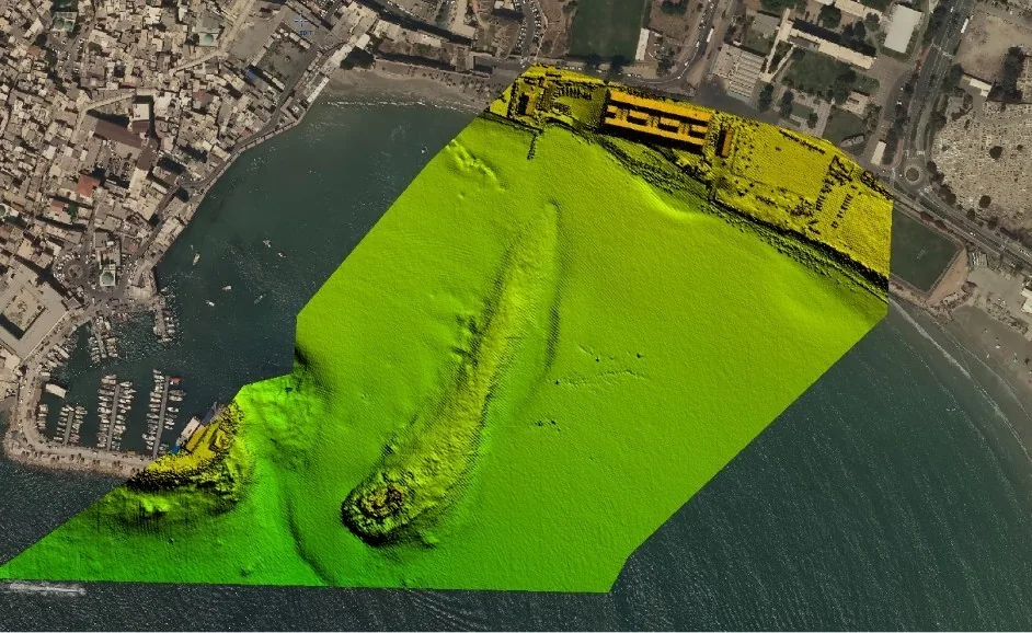
A LiDAR scan of Akko’s harbour and old city — a continuous elevation model of the port, breakwater and adjacent seabed.
An airborne LiDAR scan by Hetz Hazafon of the Akko harbour area: a single deliverable joining land, walls and port with the shallow seabed, draped over the digital aerial photo from the same flight.
A scan like this supports harbour works planning, documents seabed change, monitors erosion and yields 3D sections and models — without operating vessels in shallow water.
The scan is combined with colour RGB and NIR digital aerial imagery from a precise mapping camera, so every point in the point cloud also carries its true colour.