Mapping · Surveying · Geodetic Engineering

Leading the world of Surveying, Aerial Photography, Cadastre, Appraisal, Geospatial Data

Advanced solutions in surveying, photogrammetry, bathymetric LiDAR, and precise orthophoto for national infrastructure projects in Israel.

30+
Years of industry experience
70
Employees
12
Certified engineers & surveyors
2005
Founded

Who we are

About the Company

Hetz Hazafon specializes in mapping and engineering surveying, providing professional services throughout the State of Israel, while maintaining an uncompromising level of quality, personal service, and professionalism in every project. The company provides holistic services including: land surveying, aerial photography and orthophoto, aerial, marine, and LiDAR mapping, cadastre, land designation, appraisal, and land registration.

Get to know us
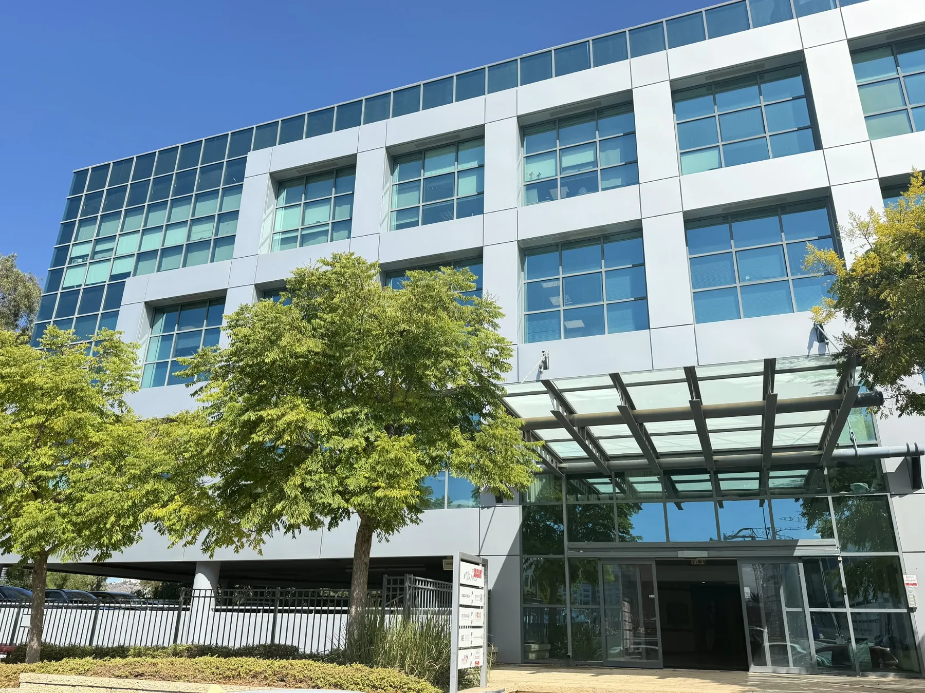
The Hetz Hazafon office building in Tirat Carmel

Projects

Flagship projects for strategic clients

Project card — Netivei Israel
Transport infrastructure

Netivei Israel — hundreds of kilometres of national roads

Surveying, registration plans and expropriations along hundreds of kilometres of roads — from Route 2 to Route 443 — plus orthophoto for the Eilat railway project.
Surveying · Expropriations · Orthophoto · Registration plans

Project card — Israel Railways
Transport infrastructure

Israel Railways — planning, expropriation & registration support

Planning support for dozens of rail projects: electrification of 450 km of track, the Valley Railway, the Eastern Railway, the Akko–Karmiel line, the Eilat line and the coastal quadrupling.

Surveying · Expropriations · Laser scanning · Registration plans

Project card — NTA
Transport infrastructure

NTA — the Metro and the Green, Brown and Purple lines

Surveys for detailed and town-plan design, boundary documentation and expropriation support for NTA — the M1S Metro section and the Green, Brown and Purple lines.

Surveying · Expropriations · Mass transit

Our edge

Why Us?

Hetz Hazafon is the leading company in Israel in the field of engineering mapping and surveying, managed by professionals with over 30 years of industry experience.

The company possesses unique knowledge and execution capabilities at the highest level of precision, built from executing numerous complex infrastructure projects completed with outstanding success.

The company provides services to strategic entities in the Israeli economy, including government ministries, public organizations, local authorities, project management companies, and planning and building committees.

The company owns unique equipment and innovative systems that enable accurate and rapid execution, holding the highest ratings.

The company holds the highest quality scores and is counted among the most high-quality supplier databases in the State of Israel in national surveying fields.

The diverse, high-quality manpower and the company's service delivery capabilities enable the execution of high-quality projects and the handling of complex and unconventional issues.

The company offers multidisciplinary services involving the integration of several departments operating in parallel — services unique to the company that require exceptional capabilities.

Our Clients

Government ministries, local authorities, corporations, and leading infrastructure companies

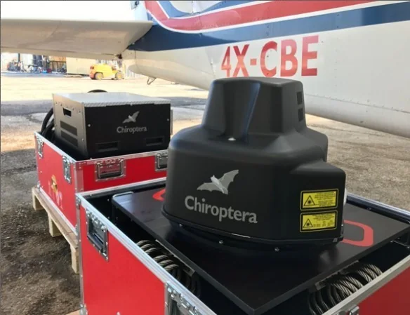
The Chiroptera 4x LiDAR system installed in Hetz Hazafon’s survey aircraft

Technology

Uncompromising Mapping Technology

Hetz Hazafon utilizes cutting-edge equipment, including the Leica Chiroptera 4x LiDAR system, enabling continuous topography and bathymetry scanning, alongside the DMC250 digital imaging system for unprecedented photo quality.

Our systems are approved by the Survey of Israel and meet the strictest ISO 9001:2008 standards.

Meet our technology & fleet

From the field

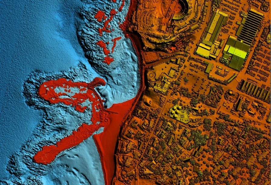
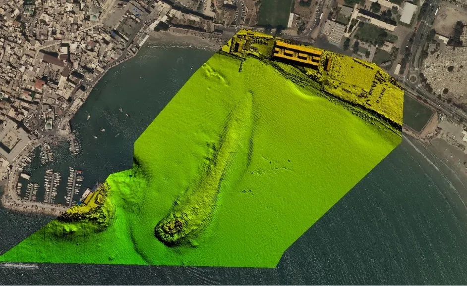
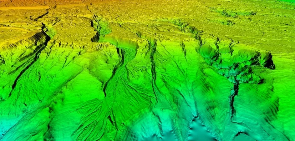
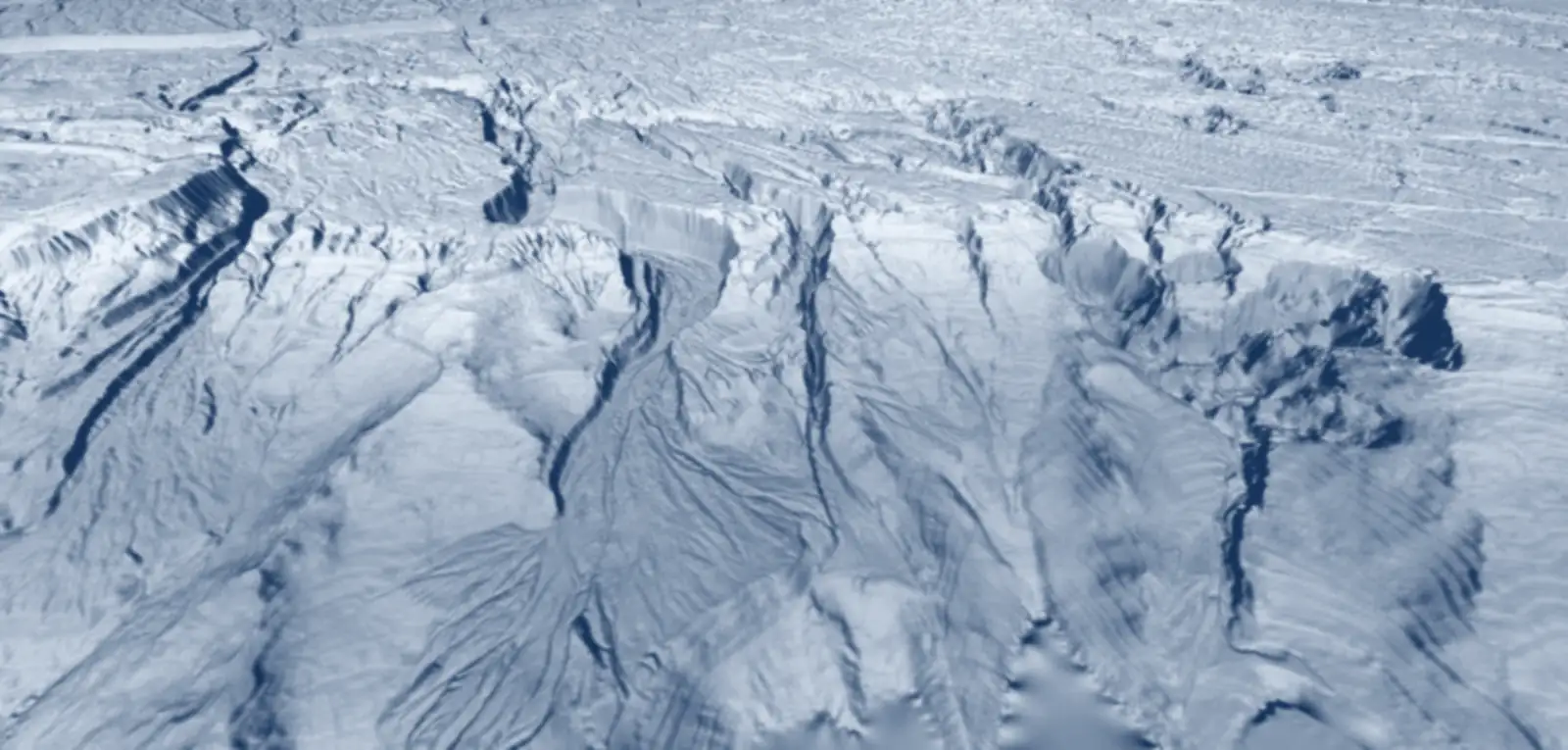
Examples of the company’s LiDAR scans

The company’s LiDAR system scans many types of terrain at different sizes, at engineering accuracy and in short timeframes.

Frequently asked questions about Hetz Hazafon

Who is Hetz Hazafon Mapping & Engineering?
Hetz Hazafon Mapping & Engineering Ltd is an established company founded in 2005, headquartered in Tirat Carmel. It specialises in mapping and engineering surveying and serves clients across Israel: land surveying, aerial photography and orthophoto, aerial, marine and LiDAR mapping, cadastre, land designation, appraisal and land registration.
What services does the company provide?
Five service areas working in parallel: aerial mapping and photogrammetry; airborne, ground and marine LiDAR scanning; land surveying; marine surveying; and appraisal, cadastre and land registration — including expropriations, registration plans and town-plan support.
What equipment does the company use?
The large-format Leica DMC250 digital aerial camera (Survey of Israel-approved for 1:250), a Leica RCD30 backup camera, the Leica Chiroptera 4x bathymetric-topographic LiDAR with a precise IMU (down to 25 m), and twin-engine Piper Aztec aircraft in which the equipment is permanently installed.
Which clients does the company serve?
Government ministries, public bodies, local authorities, planning and building committees, water corporations, planning offices, project-management companies and architecture firms — including Netivei Israel, Israel Railways, the Israel Land Authority, Ayalon Highways, NTA, Cross-Israel Highway, the Ministry of Construction & Housing and the Survey of Israel.
How many people work at the company and what are their qualifications?
About 70 employees, including 12 certified engineers and surveyors, a licensed auditing surveyor, urban planners, an appraiser, a land registrar, aerial photographers and experts in photogrammetry and airborne and marine LiDAR.
Where in Israel does the company operate?
Throughout the State of Israel — from the Galilee to the Negev, the Dead Sea and Eilat — with its head office in Tirat Carmel and projects in the north, centre and south.

Planning a mapping or surveying project?

We'll accompany you from planning to final deliverables.

Contact Us